
Did you know that there are many places in the Western United States where you can still see Oregon Trail wheel ruts? Jenn didn’t, but Brian loves Oregon Trail history! So when our epic cross-country road trip passed right by some of the Oregon Trail ruts, we decided to make a stop.
Table of Contents
{This post contains affiliate links for Amazon, Stay22, Travelpayouts and other programs. I earn a small commission from qualifying purchases made from the links on this site, at no extra cost to you. Thanks for supporting our family business!}
@dinkumtribe The value in visiting historic sites is that it helps you visualize what it truly would hsve been like to live through the events. The Oregon Trail is controversial for many reasons that I won’t dwell on here. However I can’t avoid the fact that it took incredible strength of character and even perhaps a sense of desperation to risk everything for the hope of a better life. #oregontrail #americanhistory #oregonhistory #controversy ♬ original sound – DinkumTribe ADHD family travel
This is part of an ongoing series about our family road trip from Oregon to Georgia and back. To start at the beginning, click here.
Adjusting our road trip plans
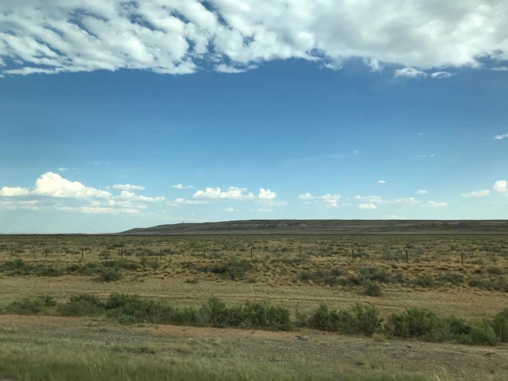
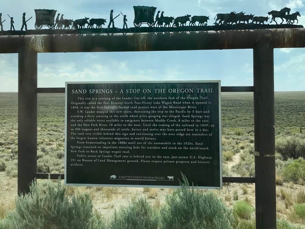
After lunching at the SAGE center we resumed our journey eastward, crossing the Blue Mountains into the far eastern counties of Oregon. Two hours later we pulled off the freeway to venture to our next stop: The National Historic Oregon Trail Interpretive Center, not far from Baker City, Oregon.
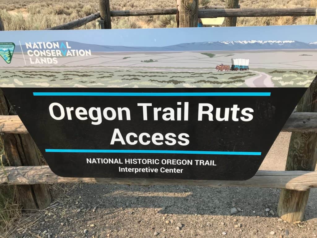
Our Roadtrippers app had identified the Center as being one of the few well-rated stops within half an hour of the freeway. We decided to take the sixteen minute drive up into the nearby foothills to check it out.
The Center was closed! We’d arrived within an hour of park closure and the gates had been shut to additional visitors, leaving us wondering about plan B. Thankfully, plan B was only a half a mile away—an interpretive trail.
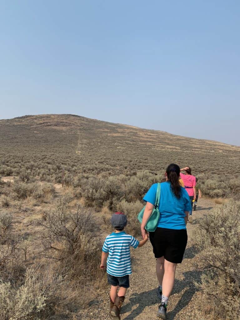
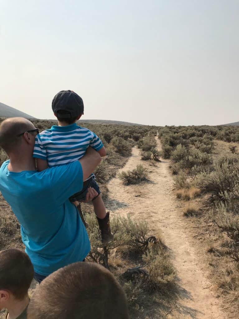
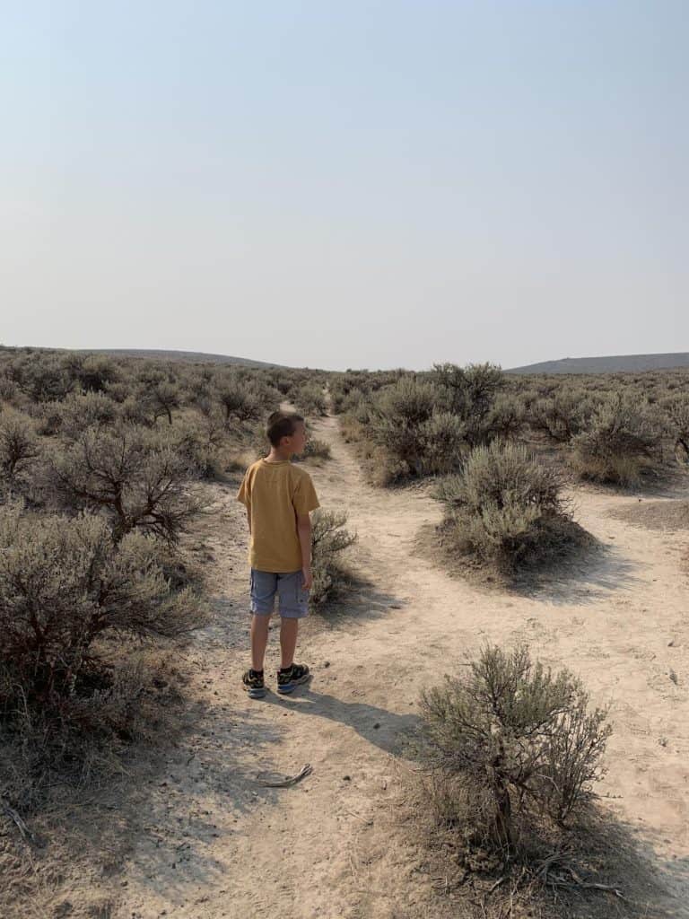
Walking in the footsteps of emigrants
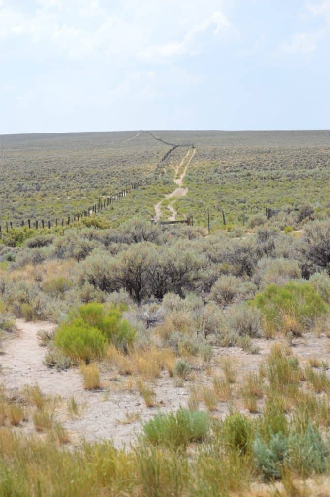
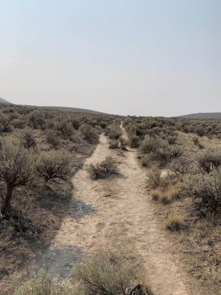
The short trail provides access to the Oregon Trail wheel ruts, tracks cut deep into the ground by countless emigrant wagons making their way west over the open terrain.
But before you yawn let me tell you that my wife and children were surprised at how worthwhile it was to actually stop and walk the tracks. In fact, I was surprised at how valuable it was, and I’m the history junkie!
We stood in the tracks and looked around at an empty, quiet scene. At almost nine miles away from the interstate, the most striking feature of the area was its silence.
Walking there among sage brush, wiping our brow, and watching for rattlesnakes, we came to a deeper recognition of what it must have been like to traverse the Oregon Trail.
I’m not sure I can comprehend what it would be to wake up every day and lead my family through 2000 miles of wild, rugged country with not much more than hope and prayer.
Though we didn’t know it at the time, we were walking the ruts of Flagstaff Hill, the place where emigrant families got their first view of the Blue Mountains—a sure sign that they were nearing the end of the trail.
One stop among many on the Oregon Trail
Our stop at Flagstaff Hill would be only the first of several encounters with the Oregon Trail. Interstate 84 and 80 follow and intersect the trail at various points in the Rockies and the Great Plains.
This affords travelers with an abundance of opportunities to catch a glimpse of history, lying silently among the sagebrush right outside their passenger window.
Frequently Asked Questions about the Oregon Trail
We’ve visited dozens of Oregon Trail ruts and historic sites since our first visit to these ruts in 2021, and we’ve learned a lot about the Oregon Trail. We recently did a question and answer session about the Oregon Trail for those who want to learn more.
Was the Oregon Trail computer game a good representation of the historic Oregon Trail experience?
In many ways the game gives relevant perspective. As characters in the game, you had to buy the right stuff. And if you didn’t buy enough stuff, or if you didn’t ford the river right, you lost it all.
What our kids thought of the Oregon Trail computer game
Our kids had never seen the Oregon Trail computer game, so when Brian found it online and decided to go and give it a shot. Our kids were sitting around there and they were all trying to figure out what they needed to buy to go to the next spot.

Then they were going to try and cross the river. They were discussing, “Should we try and ford the river?” They were collaboratively deciding what to do and they decided to go.
When they tried to ford the river, half of their supplies fell in the water! The kids were shocked: “Oh my goodness! Look at all this stuff we lost trying to ford the river! We didn’t even make it!”
@dinkumtribe Well, ok. 😅 We had so many people arguing about whether or not the video I posted showing Oregon Trail ruts (swales) were actually the real deal. My husband is a former US history teacher, and he reads Old West history books just for funsies. The Oregon Trail is his favorite side quest hobby, along with geology and Southwestern Art. So I’m not saying he can’t be wrong, but I’d be pretty surprised. 😂 Here’s a great selection of books for further study. #oregontrail #americanhistory #theoregontrail #oregontrailgeneration #booktiktok ♬ Funny Laugh Song – Bruno Portinho Trilhas para filmes
Game challenges vs. real life challenges
I feel like that’s probably one of the big draws of the game. All the disasters that kept happening in the game, it wasn’t that far off from how many disasters the original pioneers would have faced.
When you’re at the start of the trail things are relatively inexpensive so we probably spent a third of our funds getting the stuff we needed.
Then we were ferried across one river, and that was okay but it cost us $5 and two days. That’s historically accurate for the most part. And when we tried fording the other river we lost a ton of stuff.
But we said, “Let’s try to find somebody to trade.” Well, there’s only one person at the time to trade with, and they want something that we already lost! So we’re stuck.
Then when we get to the Fort, we can buy things. But of course now it’s 30% higher in cost because they have to ship it all in.
So that was, in many ways, the experience of the trail.
How does the historic Oregon Trail differ from the Oregon Trail computer game?
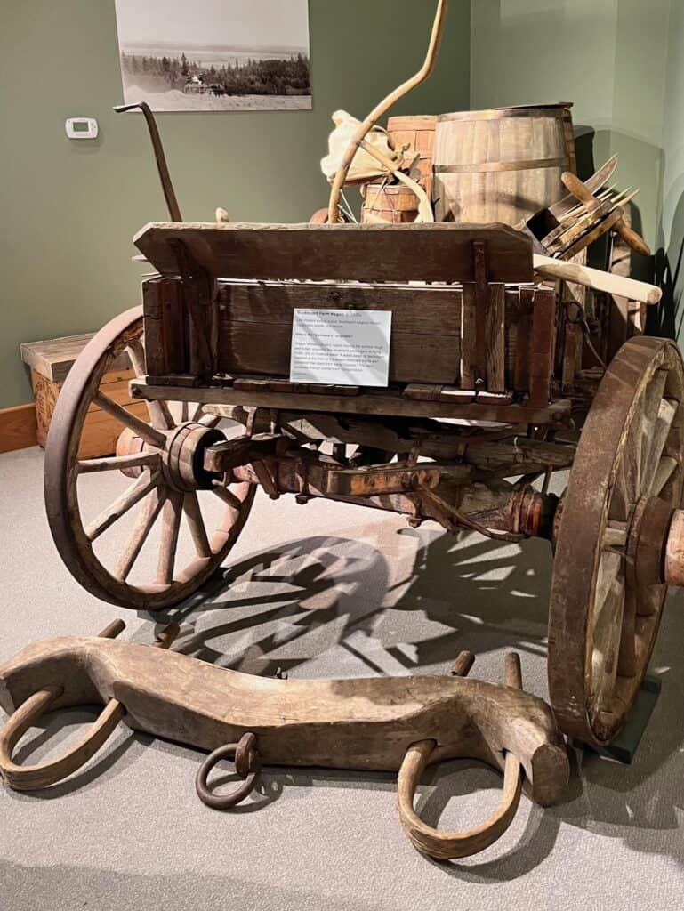
There are some things that are lacking. For example, at the beginning of the Oregon Trail period people bought all sorts of things.
These middle class families were trying to buy everything they can, and of course it’s kind of like those road trip supplies that people get. If they’re not regular road trippers, or if they’re a little bit anxious, they buy three coats when they only need one.
That definitely happened on the Oregon Trail. As the Trail developed in many ways it was like this constant thrift store, or ‘swap and share’.
Piles of abandoned junk
As you went along, sadly, you would see graves, but also other things. There would be piles of stuff alongside the Trail, because the oxen were getting tired.
So you’re 100 miles out and you’re thinking, “Let’s see is it going to be the chest or is it going to be oxen? Well let’s unload the chest and throw the chest out because we need to get to Oregon!”

There are stories about piles of bacon at the forts because people bought way too much bacon. So that isn’t in the game, but it is only a second grade game, so what do you expect?
An intense journey for all ages
We’ve visited several Oregon Trail sites that are local to where we are here. We live in Silverton, Oregon and we’re right in the Willamette Valley which is where the trail ended. So there’s a lot of sites here where we can interact with different things.
One of the things that shocked me when I started learning about the actual Oregon Trail experience was the fact that if you were older than five you were going to be walking for most of it!
@dinkumtribe Walking there among sage brush, wiping our brow, and watching for rattlesnakes, we came to a deeper recognition of what it must have been like to traverse the Oregon Trail. I’m not sure I can comprehend what it would be to wake up every day and lead my family through 2000 miles of wild, rugged country with not much more than hope and prayer. #oregontrail #americanhistory #familyroadtrip #oregontrailgeneration ♬ Oregon Trail – Woody Guthrie
Our youngest is about seven years old, and I can’t fathom him walking from Missouri to Oregon over the course of a summer! Or even over a course of a couple years if he stopped somewhere. No wonder it was such a difficult thing to do!
How big of an issue was disease on the Oregon Trail?
It was huge, especially waterborne diseases. When they say “you have died of dysentery” on the computer game – that was a real thing!
Dysentery was widespread in much of the United States especially where you had issues of food contamination and water contamination. So on the trail where everyone’s been camping… How clean are things after 5 days of camping?
If you can imagine camping while you’re steadily going across the Plains and the Rockies, you know that was a real issue. While dysentery was always there, probably one of the biggest killers was cholera.
There was a cholera epidemic that happened at the same time as when the trail was really at its height. That spread right into the Platte River Valley – what we call the Platte River Road.
Well-known Oregon Trail sites in Nebraska

The great Platte River Road in Nebraska is that stretch that everyone thinks about when you think about “Oregon Trail.” You’ve got Chimney Rock there, you’ve got Scott’s Bluff… sites which you can still visit now.
Those are sites that people go to when they’re learning about the Oregon Trail. When you think about that, you think, “Oh wow, this is so beautiful! It’s so amazing!”
Even the emigrants when they’re writing it are writing about how beautiful and remarkable and scenic it is.
The constant threat of cholera
Yet at the same token, as these emigrants were going through they saw gravesite upon gravesite, upon gravesite, upon gravesite… because the cholera epidemic just raged among the wagons.
Cholera is just a killer! Even nowadays, in some of the poor countries of the world, if cholera shows up, they they have to call and get help immediately from the World Health Organization and places like that, because cholera spreads so fast and it kills people really quickly.
So it’s not surprising to me that the Trail was so deadly.
Connection to Laura Ingalls Wilder
You can see how one death would quickly lead to another death. Wagon trains were a community effort. It was not a wise thing to simply just go out on your own.
I think of a story from Little House on the Prairie – as we know those were generally Laura Ingalls’ memories. There was a single wagon that the Ingalls came upon out there. Someone had stolen their horses.

Oxen or mules vs. horses on the Oregon Trail
If they were using horses these people haven’t adequately prepared. You didn’t take horses on the Trail; you’d take oxen because they last better on the scrub land.
Oxen could feed better on was actually available to eat on the trail. So oxen and mules were the preferred ones. Horses was a very poor choice for the Oregon Trail. In the story, someone had stolen their horses and now they were stuck in the middle of prairie land with no one to help them.
So people would go out in communities. It was a community effort to protect and to have safety in numbers.
The importance of traveling in a community
It was also a community effort just to get the wagons over certain areas. One of the highest hills that emigrant wagons had to come over on the Trail is known as California Hill.
It’s not in California, it’s actually in the Great Plains. The grade was so difficult that it involved unpacking the wagons and carefully bringing them over. Well if you have a family of 10, that’s going to be a hard job when you’re talking about getting it over.
But if you have a group of 50-80 people, you can do that. But then if cholera comes in and takes out half…I mean and cholera would take out huge numbers.
So then you have the real potential of the party not making it over these passes. Or not making it in time, running out of time, running out of supplies… so one death leads to another.
One of the neat things about researching historic Trails like this is just understanding that.
Ethical concerns about the Oregon Trail migration
You know there are problems with the Oregon Trail. We’re not making a moral judgment as to whether or not going and taking land from other people was a good plan. Obviously we don’t agree with that!

But you do have to recognize that the people who chose to do this they weren’t picking an easy route. They were choosing to do something that was incredibly difficult at the time and they had to have the fortitude to make it.
The Oregon Trail is complex. There was racism. There was slavery. There was injustice that was definitely involved.
We also need to recognize that this was a movement of people and it’s not as cut and dried as, “All of these people made a plan and did something that was illegal (stealing other people’s land).” Not everyone was doing it for the same reasons.
A mass migration with multiple routes

This was one of the largest mass migrations in history. You can say “the Oregon Trail,” but it was more like the Oregon Trails.
What we follow when we take the Oregon Trail auto tour is the primary route that most people took. But there were lots of cut offs, and lots of different ways to do the Trail.
It changed over time too. They would find a route that worked better. Some of the sites we’ve visited were places where people were trying to solve a problem, such as “How do we get past Mount Hood?” and “How do we get past the river?”
So there are several different spots that were tried until they kind of settled on one that worked really well.
@dinkumtribe My husband loves US history and geography, and he found this little gem. No marker, no google map directions, just coordinates from another enthusiast- but look how clear the Oregon Trail wheel ruts are!! Nearly 150 years later and you can still see them. #oregontrail #americanhistory #oregontravel #roadside ♬ original sound – DinkumTribe ADHD family travel
The Trail itself was not some static thing. It developed and evolved over history. They were using the Oregon Trail right into the 1910s to travel.
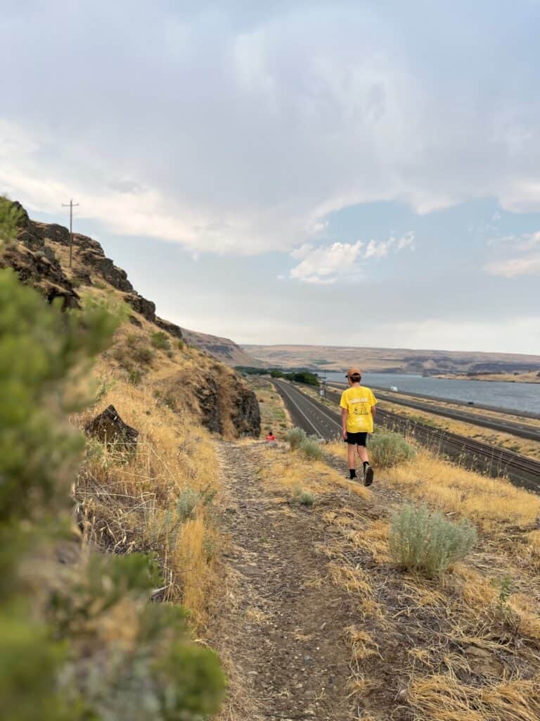
Some parts of the Trail, like the Oregon Trail ruts we saw there at Bigg’s Junction, are still getting used. It continued being used as a wagon trail and even an automobile trail for quite some time before the highway system got going, especially before the railroads.

Where did the Oregon Trail begin?
The Trail had several starting points. If we start at where the Trail really began to pick up, in the early 1840s, the primary starting point was in Western Missouri. There were a couple reasons for that.

First of all Missouri really had been the Gateway to the West since the Louisiana Purchase in 1803. That was St. Louis and Missouri was kind of just a stop along the way for the French traders in New France.
But New France was oriented north to south, while the United States and its orientation was east to west. So that made Missouri the staging point for anything they would do Westward. We had Lewis and Clark, we had the Astor party – all of those came out of St. Louis.

Kansas City and Independence
By the time you get to the early 1840s, the westernmost part of the frontier is not St. Louis on the east, but it’s Kansas City region on the west.
Missouri in 1843 was the westernmost state. So most wagon trains left in the Kansas City region, and Independence, Missouri is regarded as the official start of the Trail.

So in that region people could get the logistics they needed, and leave the westernmost state, cross the border into the remaining portion of the Louisiana Territory, the Kansas Prairie… all of this unorganized territory.
More than that, the Kansas City region had been the starting point for the Santa Fe Trail for quite some time. So it already had the machinery and logistics available for wagon trains.
In fact for the first few miles to get out of the state they followed the Santa Fe Trail southwest before turning northwest and heading over Kansas Prairie. Altogether it’s about 2,200 miles or 2,165 miles (depending on how well you did) from Missouri to the Willamette Valley in Oregon.
Where did the Oregon Trail end?
Just like the migration had many starting points it also had many ending points. When people said ‘Oregon’ back in the 1840s they didn’t mean the state of Oregon – they meant Oregon Territory.
Oregon Territory was anything from the western slope of the Rockies all the way out to the Pacific running from the northern border of California (which was Mexican California at the time) all the way up to what’s now British Columbia.
That’s the modern states of Washington, Oregon, Idaho, bits of Montana and then right up into the province of British Columbia.
So when people were coming to Oregon, the ending point for them wasn’t necessarily the Willamette Valley. You also had people going up into Washington: Olympia, Tumwater and other places.
Oregon Trail sites in the Western US

We’ve visited a few of the Washington locations for the Oregon Trail too. One of the ones we visited was the Whitman Mission in the Walla Walla area.
When you’re out here in the western part of the US, but especially here in Oregon, Washington, Idaho, Northern California – the Trail is everywhere! There are bits and pieces of Oregon Trail history everywhere in these states, and a lot of the major highways were built on the Oregon Trail.
Trails prior to the Oregon Trail
It’s important to note too that a lot of these trails weren’t even original to the Oregon Trail migration. They were indigenous people’s trails that they had used before that, or buffalo trails.
That’s how a trail works: you try and look for something that’s already in use because usually they’ve already found the easiest routes.
How much of the Oregon Trail ruts can still be seen today?
The really famous ones that most people have heard of are in Nebraska and Wyoming. Those are deep, deep ruts that are several feet wide, you can walk in them, and they actually went through sandstone.
There’s thousands of miles of the Trail that is preserved. There’s a few reasons for that.
How are the Oregon Trail ruts preserved?
One of them is that the Trail became packed earth. Think about the millions of feet, oxen, wagon wheels, and later automobile tires that went over those parts! Those ruts remain.
@dinkumtribe Replying to @kingbearcol here’s an example of Oregon Trail ruts that were overgrown by grassland, but the indentations still remain. #oregontrail #americanhistory #theoregontrail #wallawalla ♬ Mountain High – Thomm Jutz & Winston Green
Some of the ruts are in actual rock. If you go to the Guernsey ruts in Wyoming, you can see there’s deep, deep ruts that aren’t going away. There are many places where regular use left a mark.
Much of Nebraska and Wyoming are still undeveloped or have been used as ranch land. In some cases, when there’s been farmland then the ruts are annihilated because the land was plowed.
Another reason why so many of the ruts still exist is because of the effort on the part of conservationists. The work of conservation of the Trail is over 100 years old.
Meeker markers and conservation

Much of the trail we know about because of a man by the name of Meeker, who left Meeker markers. He went over the trail himself multiple times.
Meeker went over the trail as a regular emigrant. Then later on as he aged he said, “Hey, this is history I want to preserve.” So he created markers, and it was the first real effort.
He worked with the United States government, and with efforts of conservation to make sure that the Oregon Trail was preserved. So that effort has been underway for a long time.

What is a swale compared to a rut?
But even in areas where there’s more erosion such as the Barlow Road here in Oregon where it rains and snows for half the year in that spot… You wouldn’t think that the Barlow Road on Mount Hood would still be preserved. Well, you can’t see the ruts anymore but you can see the swales.
Swales are more like an indentation, kind of a well. It’s a ridge that develops on either side. So you may not have the actual Oregon Trail ruts themselves in some locations, but you might have some earthworks that have developed.
More marks of the Oregon Trail
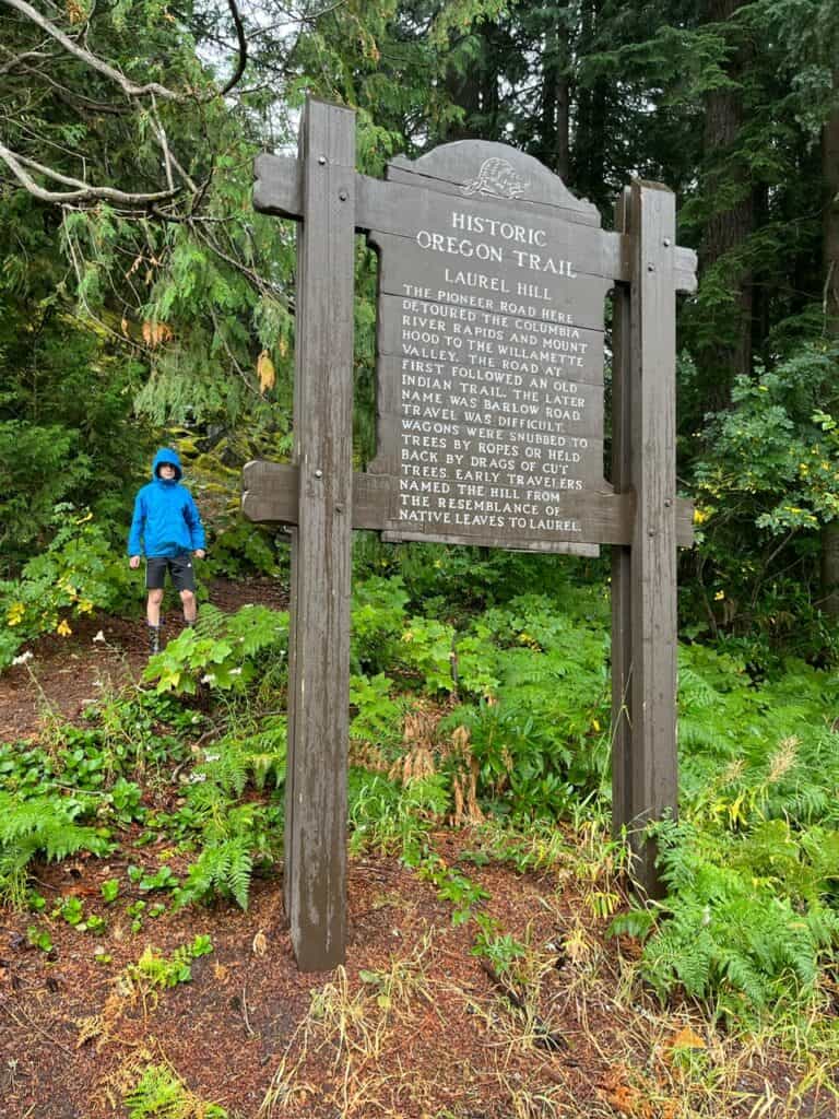
So you can see the swales, and you can see areas where they’ve moved the rocks off. There’s a part on the Barlow Road called Laurel Hill where the grade was so steep that they would have to lower the wagons down.
What they would do is, they would tie ropes around tree trunks and as they were lowering the wagons the friction ‘burned’ the trunks. It left impressions on the trunks, and those can still be seen if you’re willing to hunt and look.

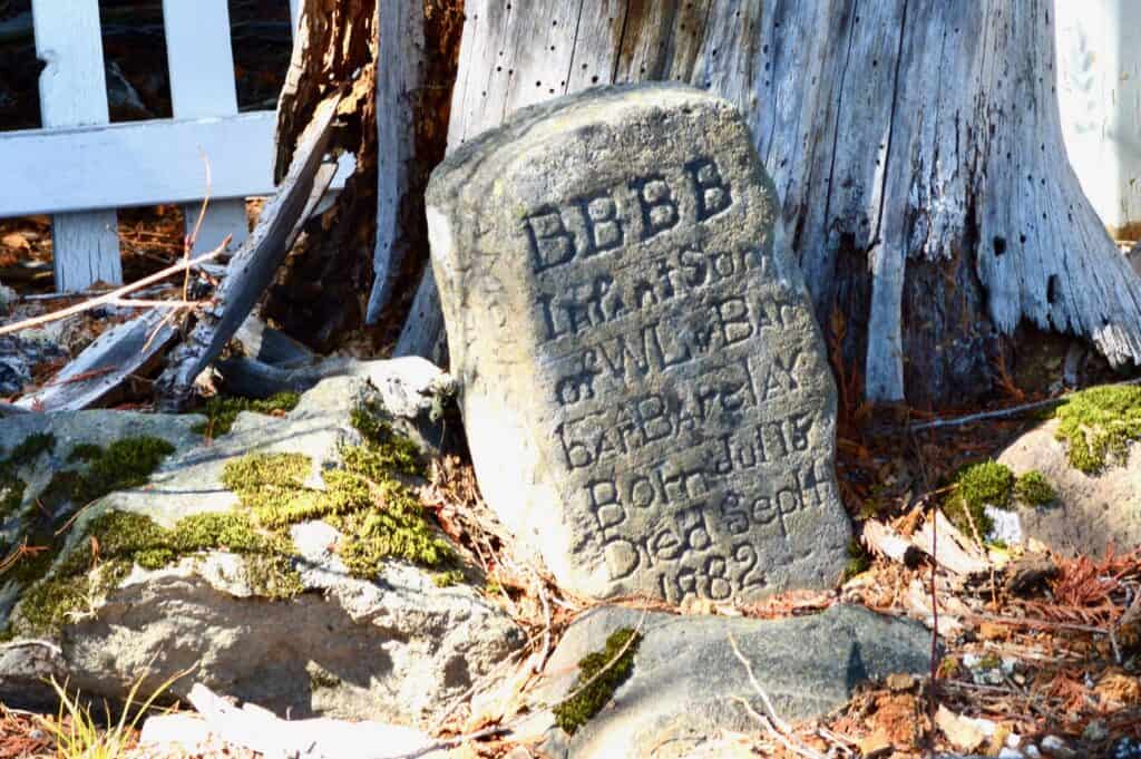
Gravesites and other artifacts
There is evidence for the Trail all along. Of course there’s graves: you can still find graves throughout the Oregon Trail that are marked.
Many of the graves were unmarked, so that’s been a work that people have done to find those. There’s a lot that have been marked and that you can still see well.
Groups that still use the Oregon Trail
There are groups that travel the Oregon Trail now. The Oregon and California Trails Association is committed to not just knowing about these places but visiting them.
For many of the Latter-Day Saints it’s one of their projects to do the Oregon Trail as teens. A lot of LDS teens do it as a project, to go along the Pioneer Trails.
So there’s preservation happening, but there’s also the fact that a lot of these trails are still being used for roads by whatever group is interested.
Great Platte River Road

The part of the trail that is best preserved is the Great Platte River Road. It’s basically 600-plus miles of trail running along the North Platte River right through Nebraska and Wyoming.
It wasn’t merely emigrants going to Oregon that took that route. That part is actually also called the Emigrant Trail because that was the route that the Mormons took. Those going to California took that route as well.
We’re talking about millions of people traveling the Trails, so it’s not surprising that in areas that are largely undeveloped and mostly arid, the Oregon Trail is still there.
How long did it take to traverse most of the Oregon Trail?
If you were leaving from Kansas or Missouri area and then you were trying to get to Oregon, you’d try to make it in one trip through spring, summer, and fall. They needed to do it in one go to try to set up winter quarters.
It was a dangerous thing for several reasons. You’d need to have a large mass of people to make something work. The Plains are known for blizzards and cold, and there are areas where you’re not going to find wildlife.
Challenges for early explorers before the Oregon Trail

For example, the Astor party in the early 1800s they traversed an area that followed the Oregon Trail for much of the way. They ran into the very issue of not being able to find people to trade with, and not being able to find food to hunt.
That may seem incredible when you think about how much wildlife there was back then, and how many indigenous people there were. But go out to the West and it might be a long time to find people.
Lack of food on the Trail

That’s why a lot of the nomadic tribes would follow the buffalo because that was their food source. There’s a lot of buffalo but only in certain places and they’re on the move.
Both with Lewis and Clark, and with the Astor party, they ran into moments of starvation in the Rockies looking for people.
They would come across indigenous tribes who would see them and run! The indigenous tribes didn’t know what to think.
The Corps of Discovery was like 30-plus men and a woman and child. Think about how much more difficult that is when you’re talking about carrying wagons!
6 months to reach Oregon

So the emigrants tried to make it in a six-month period. They endeavored to leave in the spring, but there were different ways to go about it.
If you left in March or April, on one hand you had more time but you were also more likely to deal with spring weather, and to deal with flooded streams. But you wanted to get over the Rockies you’d only have a couple months to do that.
The most important one was getting over the Rockies, over South pass. So it was basically a half year endeavor and you needed to try to get it done. You wanted to find a way to be in Oregon, if possible, by October or better yet September.
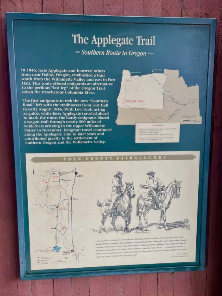
October and November were really dicey times to be able to get to Oregon Territory. A lot of folks tried to find other ways to get here – the Applegate Trail is probably the most famous example of that – and they ran into the thing that they were trying to avoid.
Where to next?
The next stop on our summer 2021 road trip was Craters of the Moon National Monument in Idaho.
Have you walked the Oregon Trail Ruts? Tell us about it in the comments!
© Copyright 2021 Brian A. Warren. Updated and expanded: February 1, 2025.


Comments
Comments are closed.